How AI, satellites, and Swiss innovation will keep thousands of self-guided hikers safe in the Alps this summer.
How much snow is still on the trail, and where exactly is it? The answers to these important questions are required for early-season hikers to assess the risk of their planned route and determine if any changes are necessary. Uncertainty around snow conditions can be costly, leading to both re-planning and risk-taking, negatively impacting what should otherwise be the incredible experience of hiking in the Alps.
For the past 5 years, The Hiking Club has been undertaking the task of providing the latest trail conditions through a human-led approach, a “Break The Trail” update from The Hiking Club team, and then ongoing daily trail reports from trail ambassadors from The Hiking Club community. Despite these programs giving self-guided hikers a comprehensive view of where the snow is on the trail at a point in time, these updates can quickly become obsolete. The Hiking Club team has been searching for a way to provide more regular snow updates in a format that is targeted and actionable.
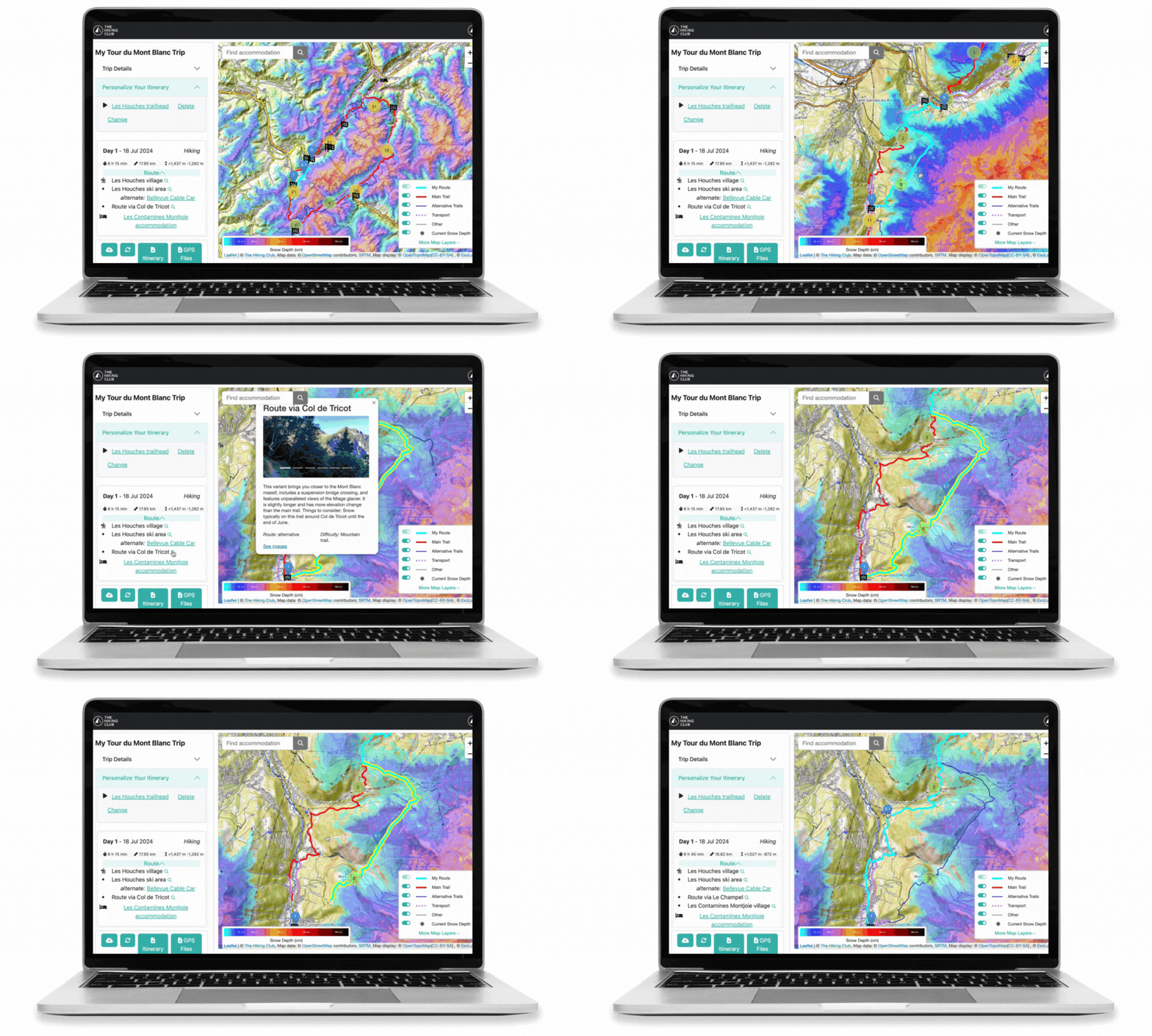
Thanks to The Hiking Club’s new partnership with ExoLabs, we’ve found it. The Hiking Club has integrated ExoLabs’ estimated current snow depth and 48-hour new snow forecast layers into the map in their trip planning app. Snow uncertainty will be a thing of the past on famous multi-day trails in the Alps, like the Tour du Mont Blanc, Walker’s Haute Route, and Alta Via 1 Dolomites.
The estimated current snow depth will be critical for hikers in June and July, to ensure they have the most up-to-date information on where the snow is located and its expected depth along the trails. The 48-hour new snow forecast will be valuable for hikers throughout the season as it will indicate where and how much snow is expected to fall along the trails for informed decisions.
Estimated current snow depth and 48-hour new snow forecast layers now available in The Hiking Club trip planning app.
These legendary trails attract self-guided adventurers from around the world who are often experienced in mountain hiking but have little or no experience in the Alps. Without having local knowledge over multiple seasons, applying general snow reports of an area to a hiking route is hard. Tour companies often use local guides to check trails and translate these reports for their clientele, but self-guided hikers who have planned their own trips don’t have access to this resource.
““It has never been easier for self-guided hikers to plan their own trips in the Alps, and by adding ExoLabs snow layers to our app, we will also help make the early season hiking experience safer than it has ever been before.””
ExoLabs has developed an innovative solution to show the expected current snow cover and snow depth on a map. Their truly novel approach feeds daily satellite imagery and weather station data, (including field readings and snow analysis), through complex models driven by modern machine-learning techniques to produce a snow distribution over the topography of the Alps and other mountain ranges worldwide. This snow projection has a 20-meter resolution and is updated daily.
The snow depth layer was validated with over 2 million data points from the Swiss Alps and achieved an average error of just 0.36 meters of snow depth. Given the high variability of snow depth distributions and the spatial resolution of 20 meters, this is considered a very accurate result. It will be a marked improvement on the single high-level snow report for a region that has previously been available to the hiking community.
Make informed route decisions based on estimated current snow depth data in The Hiking Club’s trip planning app.
The new snow layers are now available in The Hiking Club planning app, part of release V1.11, and will be the basis for our 2024 trail updates program during the early hiking season.
About ExoLabs: Linked to the University of Zurich, Exolabs specializes in environmental monitoring. Using satellite data as well as weather and climate models, and modern machine learning techniques, ExoLabs is able to gain a comprehensive insight into the condition of our environment. This valuable information is then presented in a user-friendly format in order to facilitate informed and sustainable decision-making.
About The Hiking Club: The Hiking Club allows adventures to easily plan and safely navigate legendary trails in the Alps. With a trip planning app, GPS mobile maps, and up-to-date trail information, The Hiking Club has everything a self-guided hiker and trail runner needs for their inspiring and challenging journey.


