
West Highland Way | Complete Guide
Everything you need to plan, book, and self-guide this extraordinary multi-day hike through the Scottish Highlands.
The West Highland Way is a multi-day walking trail in Scotland, considered one of the most famous in the country. The trail takes hikers through some of Scotland's most stunning landscapes, including: Loch Lomond and The Trossachs National Park, Rannoch Moor, Glencoe and scenic views of Ben Nevis, the UK’s tallest mountain.
The route showcases a mix of terrain, from gentle paths through lowland forests to rugged mountain tracks. Along the way, travelers can stay in various types of accommodation, from campsites and hostels to bed and breakfasts and hotels. The West Highland Way is popular for its historical significance and breathtaking natural beauty, drawing walkers from around the world.
KEY TRAIL STATS for “CLASSIC” ROUTE
Country: Scotland, United Kingdom
Number of days: Between 5 and 10
Distance: 155 km / 97 mi
Elevation gain: 3,900m / 12,800ft (North direction)
Highest point: 550m / 1,800ft (Devil’s Staircase)
Peak Season: April to October (although it’s possible to hike year round)
Difficulty: Easy to moderate
Traffic: High
Official start location: Milngavie, just outside of Glasgow
Official end location: Fort William

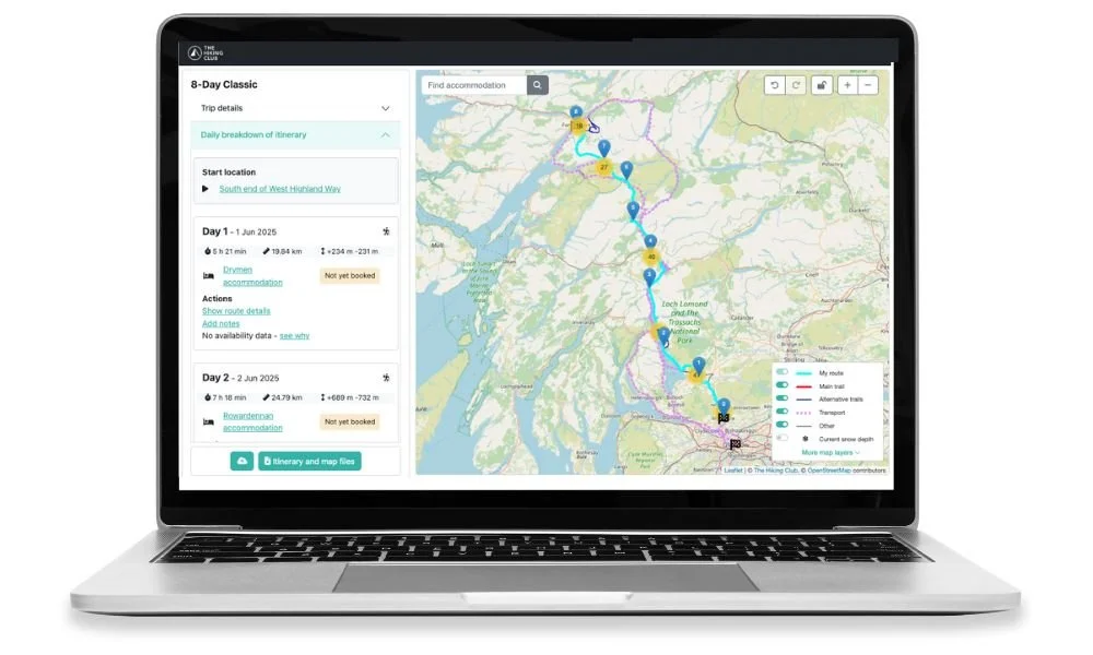
West Highland Way: High level map from our planning app showing the trail between Milngavie in the South and Fort William in the North.
Accommodation options along the west highland way
The West Highland Way offers diverse accommodation options catering to different preferences and budgets:
Hotels and Guesthouses: Comfortable, full-service stays with private amenities, typically in larger towns like Milngavie, Tyndrum, and Fort William. Ideal for those seeking comfort but may require advance booking and can be pricier.
Bed and Breakfasts (B&Bs): Family-run with breakfast included, offering a homely atmosphere. Widely available along the route, they provide a personal touch and valuable local advice but have limited rooms.
Hostels: Budget-friendly with shared or private rooms, found in places like Rowardennan and Kinlochleven. Good for social interaction and self-catering, but shared spaces may not suit everyone.
Camping and Campsites: The most affordable option, allowing for a close-to-nature experience with basic facilities. Available at key points like Balmaha and Bridge of Orchy, but requires carrying gear and dealing with weather conditions.
Bothies: Basic, free shelters in remote areas without amenities. Great for adventurers but space is limited and first-come, first-served.
Pods and Glamping: Comfortable alternatives to camping with more amenities, available in spots like Drymen. Offers a mix of outdoor experience and comfort but at a higher cost than regular camping.
Self-Catering Cottages and Cabins: Equipped with kitchens and more space, perfect for groups or families. Found in places like Tyndrum and Fort William, but often require early booking and can be expensive.
Tip: Plan accommodations in advance, especially for peak season (April > October), and consider your budget, desired comfort level, and proximity to the trail.

Bridge of Orchy Hotel

Blackwater Hostel and Campsite
EXPLORE WEST HIGHLAND WAY ACCOMMODATION IN OUR PLANNING APP
Classic trail highlights
Loch Lomond and The Trossachs National Park: stunning views as the trail hugs the eastern shore of Loch Lomond, Scotland’s largest freshwater loch.
Conic Hill: A notable climb offering some of the most iconic views of Loch Lomond and its islands.
Rannoch Moor: A vast, remote, and atmospheric moorland, one of the wildest and most isolated parts of the trail.
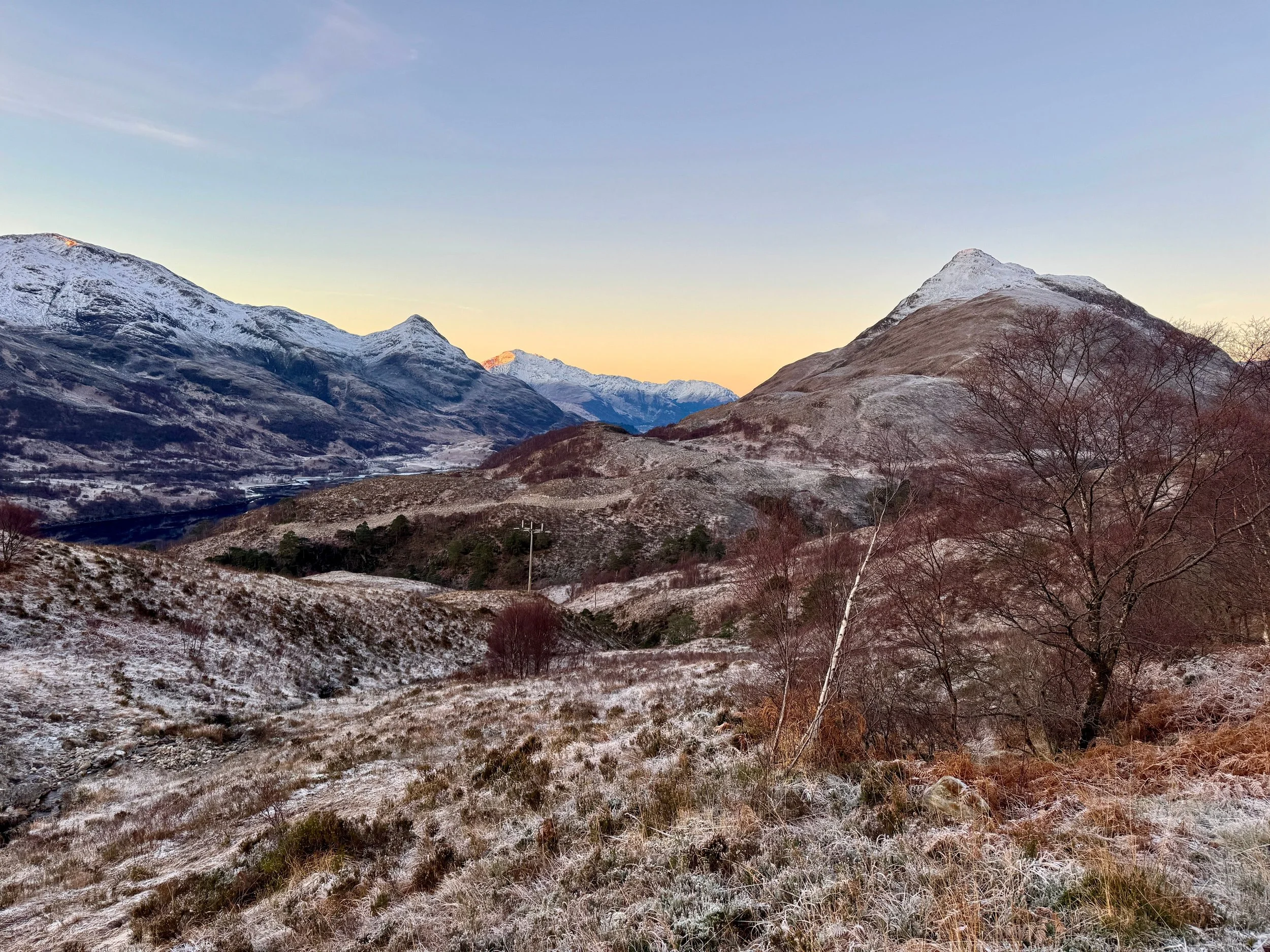
Glencoe: One of Scotland’s most dramatic and picturesque valleys, known for its striking mountains and history.
The Devil’s Staircase: The highest point on the trail, offering panoramic vistas of Glencoe and surrounding peaks making this climb a major highlight of the trail.
Kinlochleven: A village known for its history tied to hydroelectric power and aluminum production.
Fort William: A town known as the outdoor capital of the UK, located at the base of Ben Nevis, the highest peak in the UK.


popular add-ons
There are alternative routes to include additional highlights, avoid challenging sections of trail or skip highlights on the main trail by going more direct. Details of these alternate routes are available within our planning app. The most popular alternate routes along the West Highland Way, include:
Ben Lomond: A 974-meter (3,196 ft) Munro located on the eastern shore of Loch Lomond. It is one of Scotland’s most popular and southernly Munros (mountains over 3,000 feet), offering stunning views of Loch Lomond and the surrounding landscape.
Summit of Ben Nevis: many hikers choose to summit Ben Nevis upon reaching Fort William to cap off their journey with the UK’s highest peak at 1,345 meters (4,413 feet).


How long is the West Highland Way trail?
The “classic” route from Milngavie to Fort William is 154km / 96mi with 3,650m / 12,000ft in elevation gain and loss, hiking in the North direction.
It typically takes between 5 and 10 days to complete the West Highland Way. It depends on your hiking speed, the desired number of hiking hours per day, inclusion of any alternative routes, and whether you will use transport to skip ahead.


When is the best time to hike the West Highland Way?
The best time to hike the West Highland Way is generally during the late spring to early autumn, specifically between April and October.
Here’s a breakdown of what to expect during different parts of the season:
1. Late Spring (April to June)
Pros: This is considered one of the best times to hike. The weather is often more stable, with milder temperatures and longer daylight hours. The landscapes are lush and green, and wildflowers are in bloom.
Cons: The midges (small biting insects) are not as prevalent early in this period, making it more comfortable for hikers.
2. Summer (July to August)
Pros: The weather is warmest during these months, and daylight hours are at their peak, allowing for long days of hiking. Many services and accommodations are fully operational.
Cons: This is also the peak season, so the trail can be busier and accommodation at key points can be limited. Midges are at their worst, especially in the evening and in areas near water or boggy terrain, so insect repellent is essential.
3. Early Autumn (September to October)
Pros: The crowds start to thin out, and the midge season is coming to an end. The weather can still be favorable, with cooler but comfortable temperatures, and the landscape begins to change with beautiful autumnal colors.
Cons: Daylight hours start to decrease compared to the summer months, so careful planning of hiking days is needed.
4. Winter (November to April)
Pros: Trail is much quieter.
Cons: Weather conditions can be unpredictable and harsh, with increased chances of rain, snow, and strong winds. Short daylight hours and potential snow on higher ground make hiking more difficult. Some facilities and accommodations may also be closed during this period.

August on the West Highland Way
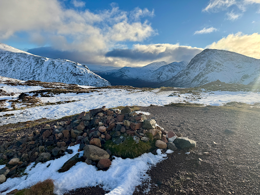
Winter on the West Highland Way
How popular is the West Highland Way?
The West Highland Way is one of Scotland’s most popular long-distance hiking trails, attracting 50,000+ walkers each year from around the world. Its popularity has grown steadily since it was officially opened in 1980.
Why is it so popular?
Scenic beauty: The route offers some of the most stunning landscapes in Scotland and its diverse terrains—from woodlands to mountain passes—make it a visual feast for hikers, contributing to its broad appeal
Difficulty: While challenging in parts, it's not as technically demanding as some other famous trails, such as Tour du Mont Blanc or Alta Via 1 Dolomites, making it suitable for both seasoned trekkers and enthusiastic beginners. The trail is well-marked, with excellent facilities and infrastructure, making it an attractive option for those new to long-distance hiking.
Accessibility: Its proximity to Glasgow (starting point) and Fort William (end point) makes it easy for both local and international visitors to access.
Due to its popularity, most hikers choose to book accommodations ahead of time, reducing the logistical challenges and enhancing the experience.

How much does it cost to hike the West Highland Way?
The cost of walking the West Highland Way can vary depending on several factors, including the type of accommodation, meals, transport, and any additional services like luggage transfers.
Based on current prices, the estimated total cost for a 7-day hike (south to north):
Budget Option (Camping/Hostels, Self-Catering Meals): £350 to £500
Mid-Range Option (B&Bs/Guesthouses, Eating Out): £600 to £900
Comfortable Option (Hotels, Eating Out, Luggage Transfer): £1,000 to £1,500
Read detailed blog “How much does it cost to hike the West Highland Way” to find out the above breakdown by accommodation, food, and transport.

Delicious meal at Kingshouse
Where does the West Highland Way start and end?
The West Highland Way starts in Milngavie, a small town located just north of Glasgow in central Scotland. It then travels through the Scottish Highlands, passing through stunning landscapes, including Loch Lomond, Rannoch Moor, Glencoe, and Ben Nevis.
The trail finishes in Fort William, a larger town situated at the foot of Ben Nevis, the highest mountain in the UK.
For those looking to shorten their walk, there are many options to start/end along the trail, including: Drymen, Crianlarich, Tyndrum, Bridge of Orchy, Kingshouse, and Kinlochleven.
All these locations are available in our planning app to select as your “start” or “end” point, with associated transport details.

Choose “South end of West Highland Way” (or other locations) as your start/end in our planning app for accurate daily hiking stats and transport options to reach the trailhead.

Official start line in Milngavie
READY TO START PLANNING YOUR WEST HIGHLAND WAY ADVENTURE?
How difficult is the West Highland Way?
The West Highland Way is considered an easy to moderate long-distance trail. Its difficulty depends on factors such as fitness level, experience, weather conditions, and how many days you choose to complete the hike. Here’s an overview of what makes it manageable or difficult:
1.Distance and Duration:
The main trail covers 97 mi / 155km and typically takes 5–10 days to complete, averaging about 12–20 mi / 19–32 km) per day depending on the hiker’s plan.
Breaking it into more days with shorter distances per day makes it more manageable, while completing it in fewer days increases the challenge.
2. Terrain:
The trail covers varied terrain, including paved paths, forest trails, rocky and uneven paths, and boggy moorland.
Sections like Rannoch Moor are remote and exposed, offering beautiful but potentially challenging hiking, especially in poor weather.
During and after heavy rainfall, some crossings between Inversnaid and Inverarnan may be impassable.
3. Midges:
From late spring to late summer, midges can be an annoyance, particularly in the mornings and evenings, adding a layer of discomfort if not prepared with repellent and head nets.
Read more details in our blog “How difficult is the west highland way?”


Scotland’s weather is notoriously unpredictable. Expect rain, wind and fog, even in summer!
Which direction to hike the West Highland Way?

Option to add Ben Nevis to the start/end of your West Highland Way hike.
The West Highland Way is typically hiked south to north, starting from Milngavie (near Glasgow) and ending in Fort William at the foot of Ben Nevis. This direction is the most popular for several reasons:
Reasons for Hiking South to North:
Scenic Progression: Hiking from Milngavie to Fort William allows you to gradually experience the trail's most dramatic and breathtaking landscapes, culminating in the stunning views around Ben Nevis.
Elevation Gain: The route has a general elevation gain as you move from south to north, with some of the steepest climbs occurring later in the trail (e.g., Devil’s Staircase and the climb into Glencoe). Hiking in this direction allows you to build stamina before tackling these tougher sections.
Wind and Weather: The weather in Scotland can be unpredictable, and winds tend to be more favorable when hiking from south to north, making this direction slightly more comfortable for most hikers.
Alternative: Hiking North to South
While the south-to-north direction is the norm, some hikers choose to hike north to south, especially if they want to start with the more challenging parts (like Devil’s Staircase) and finish with the easier, lower sections. This direction may also provide a different perspective on the landscapes and allow hikers to take advantage of favorable weather patterns depending on the time of year.
Are there transport shortcuts on the West Highland Way?
Yes, there are several transport shortcuts and alternatives available along the West Highland Way for hikers who want to skip sections of the trail, shorten the overall distance, or simply avoid challenging terrain. You can utilise buses, trains, ferries, taxis and private transfers to skip ahead along the trail. These transport options can be helpful in case of bad weather, fatigue, or time constraints.
Our planning app and GPS map include all transport schedules and costs for the upcoming season.

Utilising the ferry network on Loch Lomond is an enjoyable way to skip ahead and explore the area
Is it possible to camp along the West Highland Way?
Yes, camping is possible along the West Highland Way, and it can be a rewarding way to experience the trail, especially if you're looking for a more budget-friendly and nature-focused option.
Official campsites provide amenities and a bit more comfort, while wild camping offers more freedom and a closer connection to nature. Just be sure to plan ahead, respect the environment, and bring suitable gear to handle the often unpredictable Scottish weather.
Campgrounds and bivouac locations along and nearby the trail are listed in our planning app with images, location details and hiking stats to get to/from the trail.
Read our detailed blog “Complete guide to camping the West Highland Way” for more details on camping restrictions and permit requirements.
Find 150+ accommodation locations in our planning app, including campgrounds and permitted bivouac locations.