We’re deep in development and just weeks away from having the first version of our new itinerary planning app ready for hikers to use. In this update, I wanted to share 5 features that you’ll absolutely love!
Let’s take a closer look at each feature.
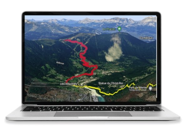
Visualise your route: Virtually hike along the trail to discover all the different options and choose the route that is best for you
Visualise your route
There is no better way to discover what and where all the different route, accommodation and transport options are than to see them on one complete map.
Our 3D interactive map brings the trail to life so you can virtually hike along the different routes available to design your perfect experience.
Personalise your adventure: Our app will guide you along the trail to choose your own route, accommodation and any transport
2. Personalise your adventure
Every hiker is different, therefore every itinerary should be too.
Choose your preferred number of hiking days to start with the most evenly divided itinerary along the standard trail. Then it’s over to you to explore and choose the routes, accommodation locations, and any transport.
Key hiking stats, such as distance, elevation gain/loss, and estimated hiking time are updated automatically as you create your plan.
3. Real-time accommodation availability
Don't waste time creating an itinerary with accommodation that doesn't have availability.
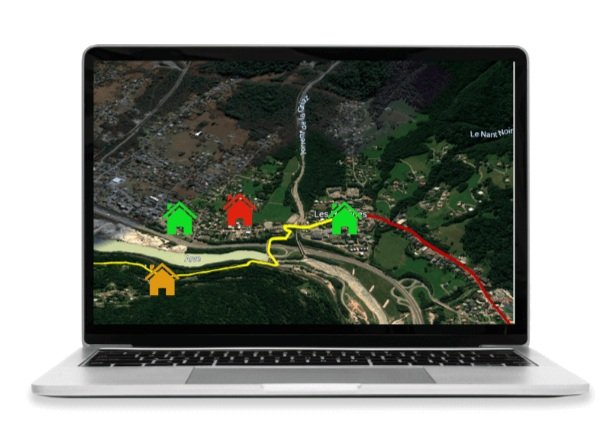
60% - 80% of properties along the trails we support have their availability listed online. Our app is plugging into them so you can immediately see whether the accommodation you want is available for your planned dates. If it isn’t, you’ll be able to adjust your dates, plan, or accommodation choice straight away.
Real-time accommodation availability: Create an itinerary that is available to book in one session
Navigate with confidence: Your route door to door along the trail
4. Navigate with confidence
We turn the itinerary you create into a personalised map file that goes from door to door of the accommodation you’ve chosen along the entire route.
Load this file into the preferred mobile navigation app of your choice or use Organic Maps, our navigation app partner for 2023.
Organic Maps is free, easy to use, works offline, designed for low battery and respects your privacy with no sign-ups or tracking.
When using your personalised map file Organic Maps, it will have different coloured markers indicating key points of interest, including toilets, water refill points, transport, food/supermarkets, and laundry locations.
Trail data you can trust: As the saying goes, “we know because we go”
5. Trail data you can trust
Our products use our own comprehensive database of trail information that has been gathered by going on many hiking adventure missions. Each year, we go back for our break the trail hikes, and engaging with customers, local property owners, and service providers, throughout the season to ensure everything stays up-to-date.
For every new trail we add, we are partnering with local guides to collect and maintain the necessary trail information. Never before have self-guided hikers been able to benefit from the experience of local guides and we are excited to bring their knowledge into our planning app.
Excited to check out our new planning app? We’re excited to show you! See our footer for our social media handles and newsletter sign-up to receive our launch announcements!
Author: Brendan Jones, The Hiking Club
Brendan is a pizza-making, craft beer-loving, peanut butter connoisseur that has been exploring the great outdoors since completing the Duke of Edinburgh Award in high school. He started The Hiking Club to democratise hiking and the benefits that come from spending time in nature.
Appreciation snacks
If you’ve found our free products and content valuable, or our paid products exceeded your expectations, we have created the following range of digital snacks you can buy The Hiking Club team to say thanks.
It’s just like a tip jar only much tastier ❤️


